As much as I try to acknowledge all comments on the WyEast Blog, I sometimes stumble across comments posted years after the original article that slip through the cracks. In the case of Gary Fields’ comment (in 2013 and shown below) on this article on the Mount Hood Lily (posted four years prior, in 2009) I didn’t notice the comment until this morning — 13 years late! So, in the interest of connecting the dots across the asynchronous digital continuum, I’ll thank Gary here for this comment:
___________
September 5, 2013 at 7:13 AM
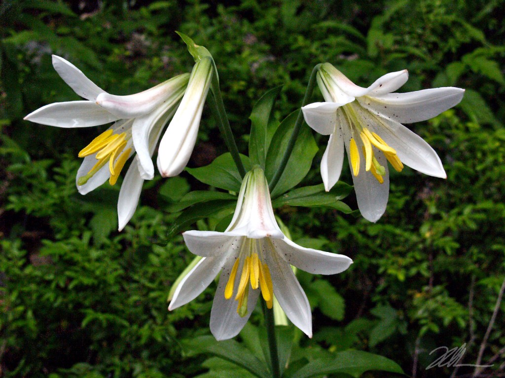
The Mount Hood Lily does indeed grow in the state of Washington. They can be found near the upper portion of Snowden Road.
___________
Gary’s comment responds to the original blog article describing confusion over the more commonly used name for the Mount Hood Lily – the Washington Lily – being named for Martha Washington, as opposed to the State of Washington.
Though the USDA and other botanical sources still describe Mount Hood as the northernmost extent of this exceptionally beautiful lily, I don’t doubt Gary’s account at all. In fact, the Oregon Flora Project includes several entries in the hills above Mosier, well north of Mount Hood and just across the river from Snowden Road in Washington. I’ve also seen Mount Hood Lily throughout the Hood River Valley foothills and along Waucoma Ridge, in the high country of the Columbia River Gorge. So, there’s a good chance they’ve jumped the river in a few spots.
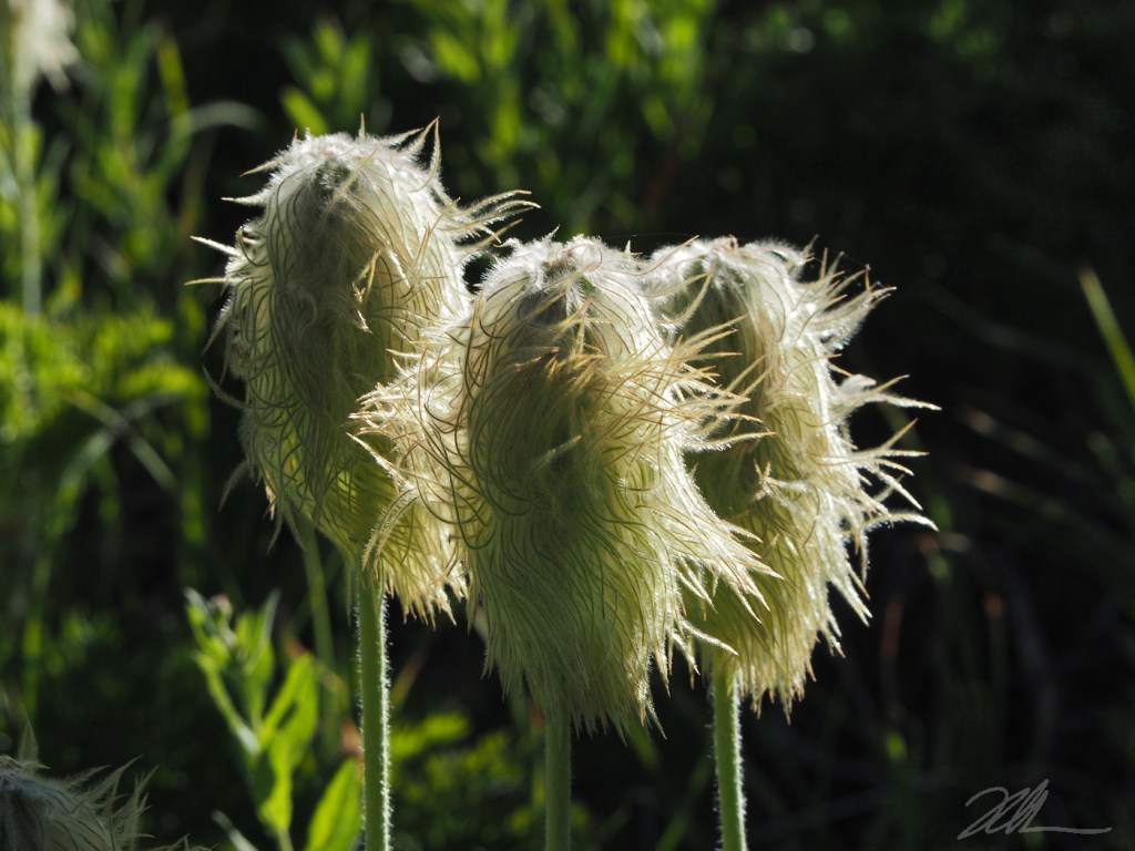
These spectacular wildflowers are blooming right now, in fact. If only this vintage 2004 image (taken with my first digital SLR twenty-two years ago!) of a Mount Hood Lily had scratch-n-sniff metadata, you could also appreciate their intoxicating fragrance that rivals any greenhouse-cultivated Stargazer lily. They are impressive plants that that are hard to miss, and commonly grow along forest roads if you find yourself up on the mountain this week. Just don’t call them “Washington Lily”…
___________
Image Description: A trio of white, trumpet-shaped Mount Hood Lily blossoms bloom in a cluster, each with six curved, white petals surrounding a cluster of bright yellow stamens and a single green pistil at center. Not shown in this photo is the aromatic, powerfully sweet scent that these stately wildflowers are known for.
Photo © WyEast Images (2026)