

As Mount Hood’s glaciers go, the White River Glacier punches above its weight in both swagger and uniqueness. Though it is now retreating in the era of climate change (like all 12 glaciers on the mountain), it nonetheless persists on the sunny southeast side. It is the only glacier on the mountain to flow into dry sagebrush country east of the Cascades, and a confluence with the Deschutes River in its deep desert canyon. The White River is also the only glacial stream with a major waterfall – White River Falls — located in a state park by the same name, just upstream from the Deschutes confluence. A section of the lower river is also protected as wilderness.
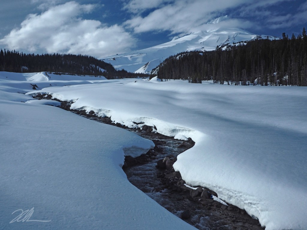
The White River Glacier flows from Mount Hood’s breached crater, into the canyon at the center in this view. The mountain’s most recent major eruptions in the late 1700s spilled vast amounts of volcanic rock and ash into the upper White River valley, burying whole forests. The debris flows created the uniquely wide, rocky floodway we see today where the Mount Hood Loop highway crosses the river.
For its part, the White River routinely changes course within its floodway, still continually rearranging volcanic debris 250 years after the eruptions – along with the loop road, itself, much to the frustration of highway officials. In November 2006, the river once again raged with floodwaters after heavy rain melted an early snowpack, taking out yet another highway bridge. Today’s very large replacement bridge was designed to be “the last” to be rebuilt here, though the White River will ultimately decide that, as it has a long history of eating highway bridges for lunch.
___________
Image Description: Clouds part on a winter evening to reveal Mount Hood against a dark blue sky, rising above the broad, snow-covered White River floodway. The last rays of light cast long shadows on the snow and light up the mountain’s summit. The White River flows swiftly from its source on the mountain in curving meanders, flanked by steep snowbanks. Shadowy mountain forests border both sides of the snowy floodway.
Photo © WyEast Images (2026)
